Certified Scanners
ULTRATOUR is scanner-agnostic. Any scanner that meets the minimum spec is certified. Two handheld levels for everyday residential, two tripod-based options for estate and commercial work.
- SLAM-based LiDAR — 200,000 pts/sec
- 80–140m scan range
- ±2cm accuracy at 10m
- 1 × 48MP fisheye camera
- 360° × 59° field of view
- Built-in 3.5" live preview screen
- Native Gaussian splat (.PLY) output
- No setup, no calibration
Best for ~90% of residential listings — condos, townhomes, single-family up to ~3,000 sqft. Included in Tier 2 Agent Bundle. Not for outdoor grounds or estate-scale.
View at 3DMakerpro →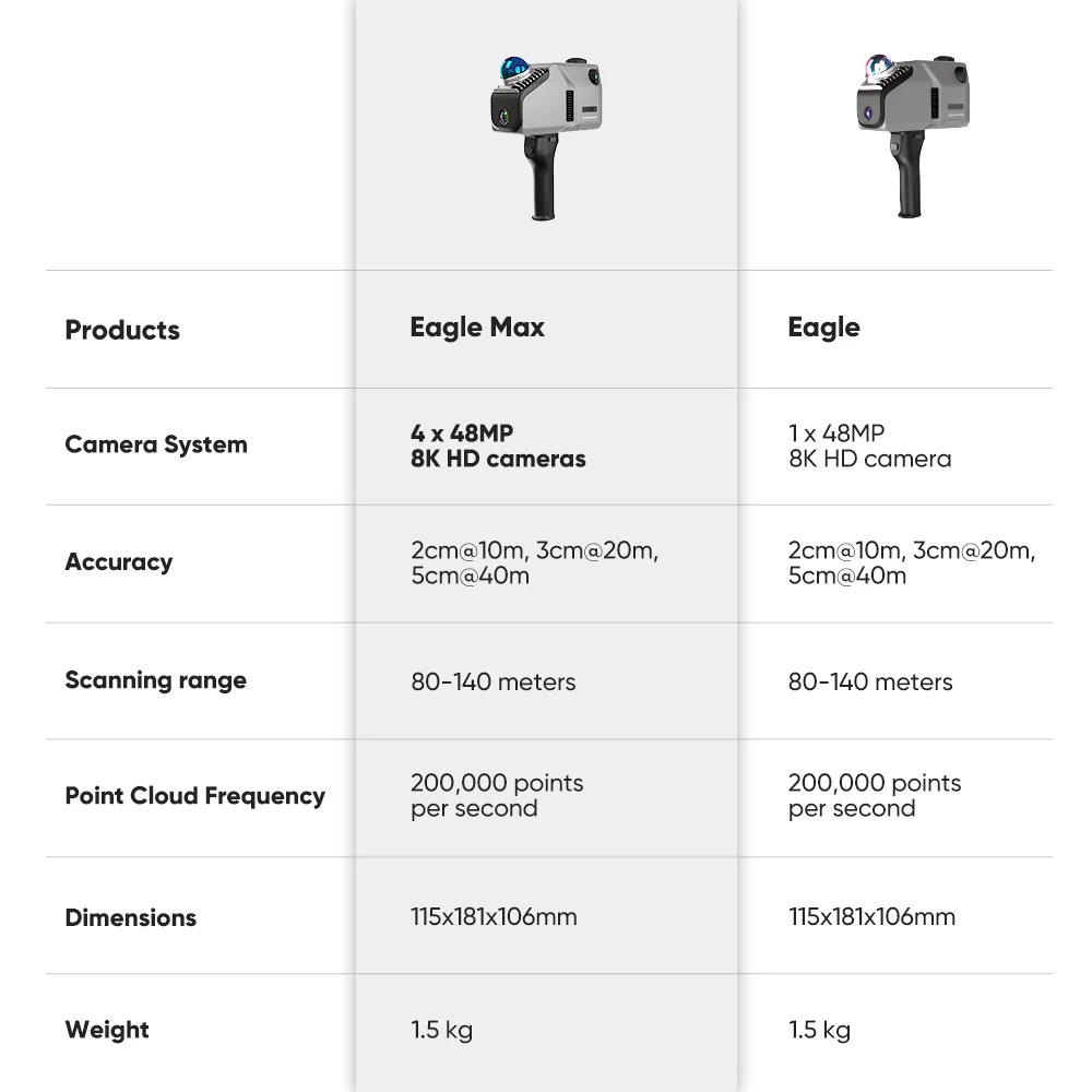
- Same LiDAR sensor as Standard
- 4 × 48MP fisheye cameras (vs 1×)
- 8K HDR panoramic color output
- 3–5 EV bracket HDR for difficult lighting
- Native Gaussian splat output
- Same no-setup operation
Identical geometry — dramatically better color and texture. Best for luxury finishes, large open-plan homes, $1M+ listings. Limited outdoor — no weather rating, avoid rain.
View at 3DMakerpro →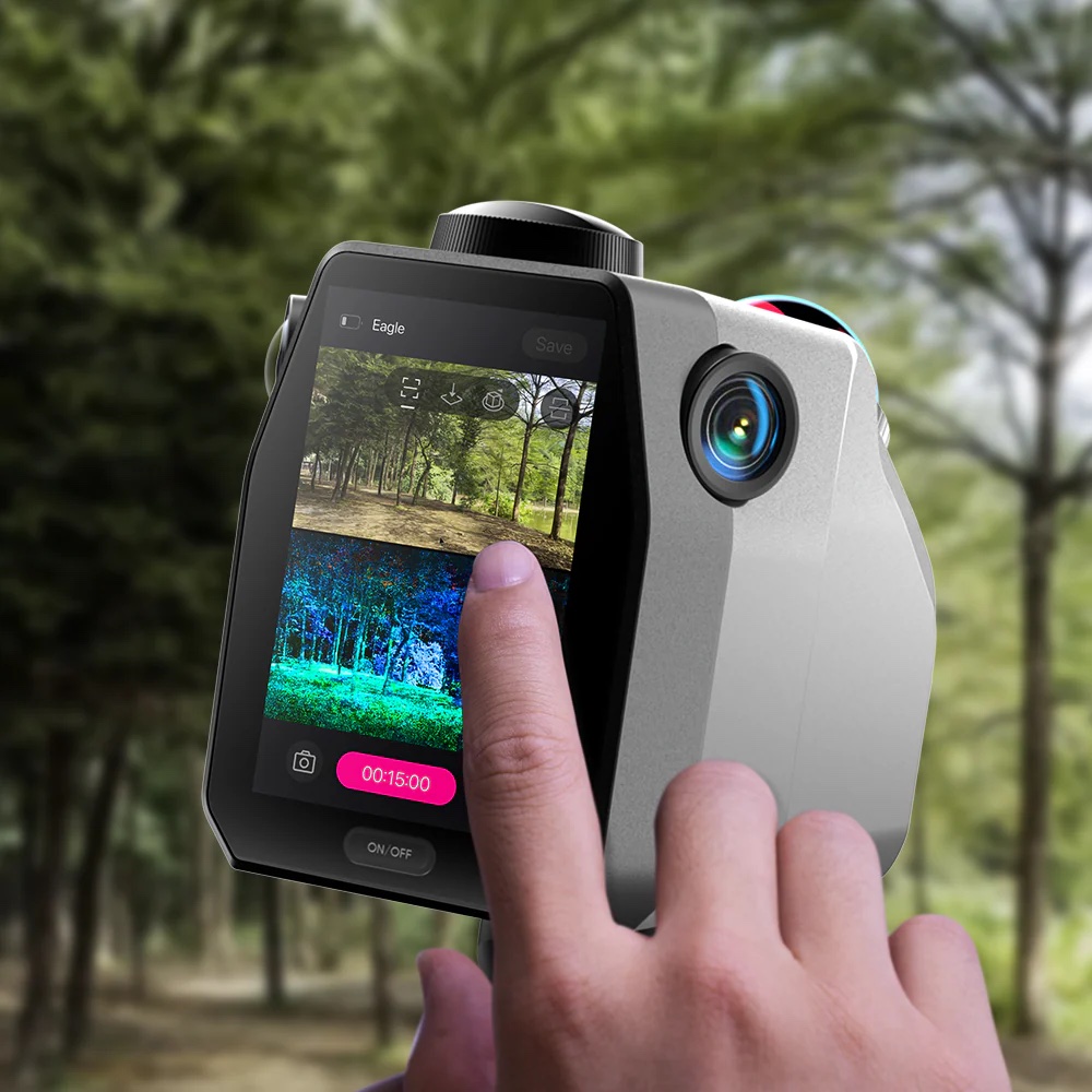
Live preview, every step
The 3.5" screen on the back shows your point cloud building in real time as you walk. You see what's captured before you leave the room — no surprises during processing.
- LiDAR sensor with 100m range
- Weather resistant — true outdoor scanning
- 20MP sensor
- Under 20 seconds per scan position
- Full indoor + outdoor seamless capture
- Standard formats — ULTRATOUR-compatible ingest
Estate-class residential — pool, patio, grounds, detached structures, acreage. Move tripod between positions.
View at Matterport →- 680,000 points/second
- Full scan + spherical images in 20 seconds
- 4 × 13MP cameras, 5-bracket HDR
- VIS auto-aligns scans in the field
- USB-C high-speed transfer
- .e57 output (ULTRATOUR-certified)
Brokerage-level asset — large luxury estates, commercial real estate, multi-building properties. Survey-grade speed and accuracy.
View at Leica →- SLAM-based LiDAR sensor (not a phone AR chip)
- ±2cm accuracy or better at 10 meters
- Dedicated color camera fusion at scan time
- Native point cloud output: .ply, .e57, or .las
- 80m+ scan range
Questions about whether your existing scanner qualifies? Ask the ULTRATOUR AI — tell it your make and model.